× logo rides mjordan
logo M Jordan

RIDES MTB

The Best
Mountain Bike
Trips
Bolivia 2024

01 - RBK
Rides jukumarca canyon Palca- Bolivia

JUKUMARCA
CAYON DE PALCA

10 %

0 %

10 %

80 %

  • Duration

    1 Day

  • Transport

    Private - 4x4

  • Group Size

    2 - 8 Riders

  • Riding Difficulty

    4 / 10

  • Physical Difficulty

    4 / 10

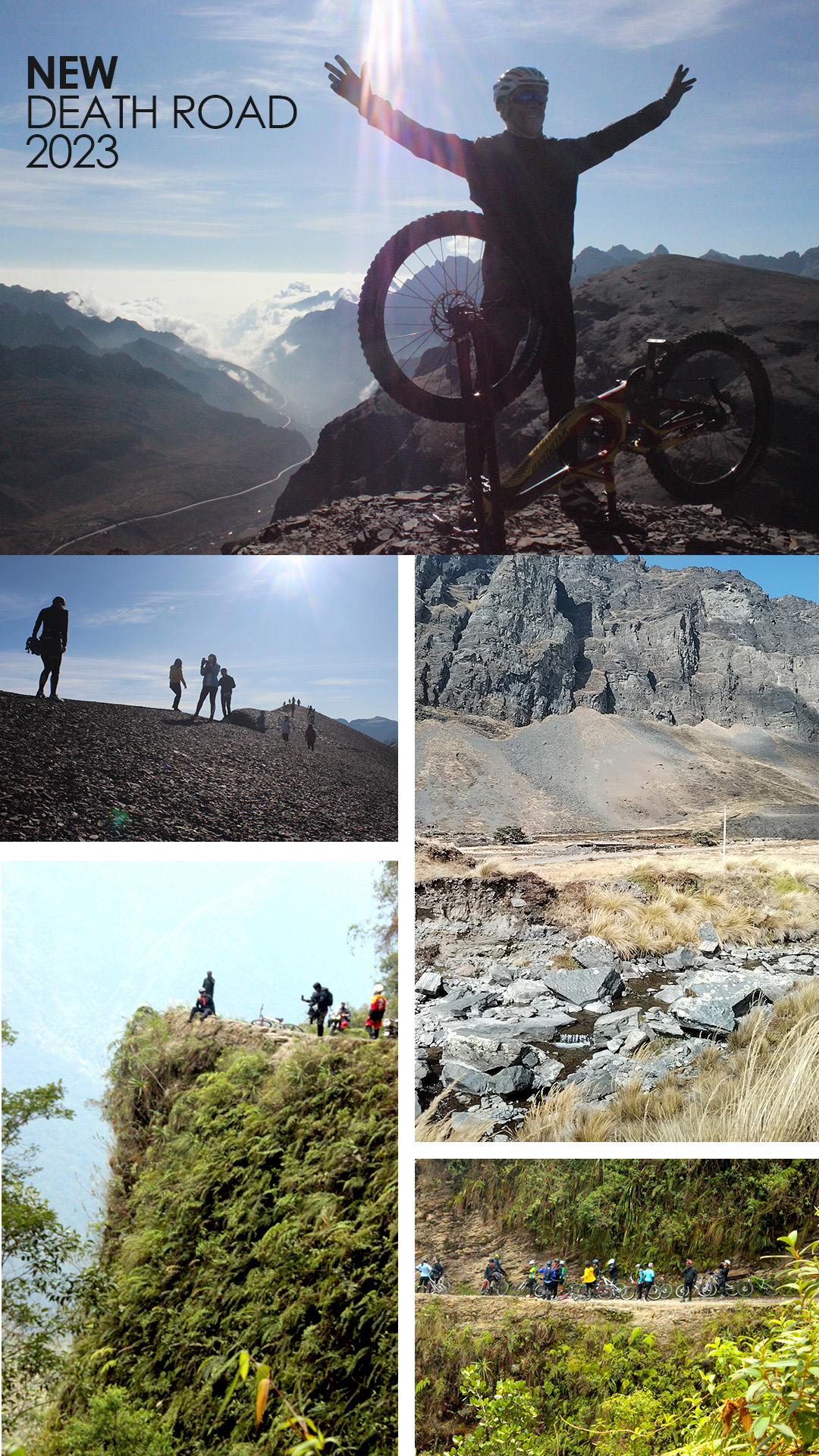
About Jukumarca
Cayon de Palca

You will be able to appreciate the imposing Illimani snow-capped mountain while you descend by bicycle, a section of the fun route where you will test your riding skills. You will then enter a canyon of giant obelisks created by the effect of water and wind, one of the best tourist attractions in La Paz.

map jukumarca ride bike

Itinerary

0 > 1

Meeting at the hotel at 8 a.m. We board the private 4x4 transport to the summit of Jukumarca. Upon arrival, the bicycles are given a final check, they are adjusted to the cyclist, safety equipment is delivered and instructions are given.

map cayon palca
1 > 2

The descent begins from 4,100 m above sea level, along a dirt road with the view of the snow-capped Illimani in front of us until we reach the community of jukumarca.

2 > 3

After a few minutes and sharing with the inhabitants of the community, we continued the bike ride until we reached the river bank. Enjoying the ride, hills of many colors and fun trails to drive. We took advantage of the stop to have lunch

3 > 4

We will do this section of the trip walking, we enter the Palca Canyon. Where we will see the 'Los Penitentes' hills eroded by the passage of time and climatic factors. An ideal place to take some good photos.

4 > 5

We walk back through the canyon to the place where we left the bikes.

5 > 0

The trip ends by boarding the transport and arriving at the hotel in La Paz - Starting point.

Include

Professional guide.
Transport 4x4.
Use of top end bike maintained after every ride by professional mechanics using original parts.
Use of High End Safety Gear (Helmet, Gloves, Knee / Elbow).
Lunch.
Drinks and snacks.

02 - RBK
Bike isla del sol

THE HIDDEN SIDE OF
ISLA DEL SOL

40 %

0 %

20 %

40 %

  • Duration

    1Day

  • Transport

    Private

  • Group Size

    4 - 8 Riders

  • Riding Difficulty

    3 / 10

  • Physical Difficulty

    3 / 10

About the Hidden side of
Isla del Sol

The solution to discover and enjoy the other side of the Isla del Sol is bicycles. Most people who travel to the "Island of the Sun" do not know the other side of the island because they have to walk 10 km and it takes a long time. Unfortunately they do not know one of the most amazing places at the lake. A labyrinth of ruins, archaeological heritage, white beaches and crystal clear water, a mystical place where we will perform a ceremonial ritual practiced by the community's shaman.

map Copacabana - The Sun Islad

Itinerary

0 > 1

Departure from Copacabana - Lake Titicaca at 8am. The guide delivers the bicycles, safety equipment and gives them the necessary instructions. We will head to the quay and take a boat to the Isla del Sol where the Yoman community lives.

map strais Incas
1 > 2

We will carry our bicycles up the Inca stairs and a section of the road, approximately 200m until we reach the highest part of Isla del Sol.

2 > 3

We will hydrate, have a snack, and begin the bicycle tour along the old stone path that goes through the highest part of the mountain. From this height, you have an unparalleled view of Lake Titicaca. Upon arriving at the Challapampa community we will take a short break and have lunch.

3 > 4

We continue our journey by bicycle until we reach the ruins. In the Chinkana Labyrinth we will take a tour of the ruins guided by a local Shaman.

4 > 5

We continue towards the white sand beaches and crystal clear water, where the Shaman will perform a ceremonial ritual, a cleaning and preparation to cross the stone arch ( Arku Punku ) that connects us with another dimension. After the ritual we will put into the waters of Lake Titica.

5 > 0

We return to our starting point making (Copacabana),stops at places of great beauty to take photos. (Boat)

Include

Professional guide.
Transport by minibus or small bus.
Use of top end bike maintained after every ride by professional mechanics using original parts.
Use of High End Safety Gear (Helmet, Gloves, Knee / Elbow).
Lunch.
Drinks and snacks.

03 - RBK
Cross Contry MTB lake Titicaca

LAGO TITICACA
CROSS COUNTRY

100 %

0 %

0 %

0 %

  • Duration

    1Day

  • Transport

    Private

  • Group Size

    4 - 8 Riders

  • Riding Difficulty

    3 / 10

  • Physical Difficulty

    3 / 10

About Lago Titicaca
Cross Country MTB

A unique place in the world to ride a bicycle. This route borders Lake Titicaca, providing dreamlike landscapes, people and culture of the lake. It is not a route that requires much driving technique. Without a doubt a tour that you have to do if you like cycling and photography. Always with a support vehicle throughout the journey.

map La Paz - Huarina

Itinerary

0 > 1

At 6 am. We will pick you up at your hotel in a private transport. We begin the trip until we reach the town of Huarina where we will have breakfast and have the opportunity to interact with locals.

1 > 2

We continue the trip by transport until we reach the Tiquina Strait, where we will make another stop.

map strait tiquina lake Titicaca
2 > 3

In the Tikina Strait, the most daring will be able to tour the strait on a 1000-meter-long zip line, adrenaline and a unique view. The other people who do not mind doing the zip line will be able to cross the strait by boat.

map cross contry mtb lake titicaca
3 > 4

In San Pedro we begin our Cross Country trip bordering the lake, while we contemplate its grandeur at 3812 meters high. Upon arriving at Villa Amacari we will stop for lunch.

4 > 5

We return to the bikes and continue pedaling along the lake taking photos, appreciating this ancient culture and tradition. We will reach the Calata Grande viewpoint, we will hydrate ourselves and have a snack.

5 > 6

It is the final route of the bicycle trip, we ride along the entire upper part of the mountain until we make a small descent and continue along the lake to the town of Tito Yupanqui.

map Tito Yupanqui - Copacabana
6 > 7

We finish the bike tour, take a short break and get on the transport to head to Copacabana, where we will take a short walking tour and visit its famous cathedral.

7 > 0

We board the transportation back to the city of peace to the hotel. If you wish, you can stay in Copacabana.

Include

Professional guide.
Transport by minibus or small bus.
Use of top end bike maintained after every ride by professional mechanics using original parts.
Use of High End Safety Gear (Helmet, Gloves, Knee / Elbow).
Lunch.
Drinks and snacks.

04 - RBK
Cross Contry MTB Down River La Paz

RIO ABAJO
CROSS COUNTRY MTB

10 %

10 %

40 %

40 %

  • Duration

    1Day

  • Transport

    Private

  • Group Size

    4 - 8 Riders

  • Riding Difficulty

    3 / 10

  • Physical Difficulty

    3 / 10

About Rio Abajo
Cross Country MTB

Down river is the place where many of the products consumed in the city of La Paz are grown, a valley of contrast the green of the crops and the multiple colors of the arid hills. An ideal area for cycling. You will descend from the condor's nest, the starting point of the paragliders, passing through cactus valleys until you reach the river bank where you can observe the farmers at their crops.

map La Paz - Yanari

Itinerary

0 > 1

The private transportation will be waiting at the hotel door at 8 am, and we will leave for Yanari Alto (condor's nest). At this place the bicycles and safety equipment will be delivered, giving the necessary instructions for the bicycle trip.

map MTB Yunari - Palomar
1 > 2

The bike ride begins with a gentle but very fun descent, with a beautiful view of the valley accompanied by the snow-capped Illimani.

map MTB Palomar - Huaricana
2 > 3

At the end of the descent we make a stop to hydrate ourselves and eat a small snack, then we continue on the bikes along the path next to the Irpavi River to Huaricana.

3 > 4

Upon arriving at Huricana we will take a break, have lunch and continue along the path down river, crossing the bridge and ending the tour in the town of Tahuapalca.

4 > 0

In the private transportation that accompanied us the entire trip as assistance, we returned to the city of La Paz to the starting point.

Include

Professional guide.
Transport by minibus or small bus.
Use of top end bike maintained after every ride by professional mechanics using original parts.
Use of High End Safety Gear (Helmet, Gloves, Knee / Elbow).
Lunch.
Drinks and snacks.

05 - RBK
Ride biking urban La Paz - Bolivia

CABLE CAR
URBAN BIKE RIDE

20 %

0 %

20 %

60 %

  • Duration

    1 Day

  • Transport

    Private - Public

  • Group Size

    1 - 6 Riders

  • Riding Difficulty

    3 / 10

  • Physical Difficulty

    4 / 10

About the Cable Car
Urban Bike Ride

Get ready for something different, discover the city of La Paz by going up by cable car and going down its streets by bicycle. This city is perfect thanks to its topography for those who like to drive downhill and enjoy adventures to the fullest. This Urban Route with places, streets that you don't know and a beautiful urban forest with large trees and paths. After this adventure you will see the city of peace in another way... A city full of adrenaline.

map cable car ride bike

Itinerary

0 > 1

Pick up at hotel 8:30 a.m. in private transportation and we will go to the starting point of the Mjordan bicycle center and workshop located in Llogeta. In this place the bicycle, safety equipment is delivered, the bicycle is adjusted to the rider and the necessary instructions are given.

We left by bicycle to the cable car terminal in Sopocachi.

1 > 2

We take the cable car and go up to the city of Alto ( Ciudad Satélite zone) with the bicycles, on this journey we will be able to appreciate the city from above.

2 > 3

We get off the cable car and ride our bikes until we reach the entrance to the Pura Pura forest park.

3 > 4

We begin the descent to the southern part of the city along Avenida del Poet, arriving at Calacoto, where we will have lunch.

4 > 5

We advanced a few blocks by bicycle and took the cable car and went up to the city of Alto Zona Ciudad Satélite.

5 > 6

We make the descent to the starting point, ending the trip. Then you will take the private transportation that will leave you at the door of the hotel.

Include.

Professional guide.
Transport by minibus or small bus.
Cable car tickets.
Use of top end bike maintained after every ride by professional mechanics using original parts.
Use of High End Safety Gear (Helmet, Gloves, Knee / Elbow).
Lunch.
Drinks and snacks.

06 - RBK
Rides new death road Bolivia

DEATH ROAD 2.0

10 %

0 %

0 %

90 %

  • Duration

    1 Day

  • Transport

    Private

  • Group Size

    4 - 17 Riders

  • Riding Difficulty

    4 / 10

  • Physical Difficulty

    3 / 10

About Death Road 2.0

It is time to overcome your fears and feel how the adrenaline runs through your veins as you travel one of the most dangerous roads in the world, a narrow road full of curves. On one side the mountain and on the other ravines with a 90-degree angle where you cannot see the bottom. From 4900m / 15,419ft high to 1200m / 3937 ft, a great descent where you can see how in a few hours the mountainous landscape changes to the tropical jungle of the Yungas.

map la cumbre death roat bike

Itinerary

0 > 1

Pick up at the hotel at 6:00 a.m. in private transportation, early departure to avoid the distress of traffic congestion when crossing the city of La Paz towards the summit of the Yungas Highway. Upon reaching the summit, we go up in the vehicle to the area of the antennas and if you wish, you can take a short walk to view the Valle de los Yungas and the entire Cordillera Real mountain range from a unique and privileged (exclusive) place. Bicycles and safety equipment are supplied, and adjusted for each rider plus recommendations and tips are given.

map cumbre star death roat
1 > 2

We begin the descent from 4900m / 15419 feet, a new section of the route designed for a better test drive, there is no traffic on this road and it allows the rider to get used to riding without much risk. It also offers landscapes and experiences that cannot be seen from the new asphalt road.

2 > 3

After getting used to handling the new bicycle, we take the new asphalt road until we reach the location where the Death Road starts. We make a short stop to check that everything is in order.

map death roat
3 > 4

We will continue a few more kilometers and stop at the Death Road outlook, in this place, you can climb a two-story platform to appreciate a large part of the entire route that will be traveled.

4 > 5

This section of the route is full of sharp curves, with ravines, waterfalls that fall on the road, and lush vegetation, unique places where we will stop to take photographs.

5 > 6

The descent continues, the change in landscape and vegetation will become very obvious, the temperature increases and it is necessary to make a stop to hydrate and leave the clothes that kept us warm in the vehicle. We make this necessary stop at the mono zipline and cafe. The zipline is optional.

6 > 7

The final stretch of the Death Road is at 1300m to 1200m above sea level. There the route becomes much easier but you still have to be careful as the speed and the desire to finish gradually increase. When we reach the end of the trail, we have made it, and a natural swimming pool awaits us, we will have lunch in this place and cool off by dipping in the pool.

7 > 0

We will use private transport back to the hotel in La Paz on another safer route.

Included

Professional guide.
Transport by minibus or small bus.
Use of high end bike maintained after every ride by professional mechanics using original parts.
Use of high end safety gear (helmet, gloves, knee/elbow pads).
Lunch.
Drinks and snacks.

07 - RBK
Rides death road Bolivia- rafting Rurrenabaque

DEATH ROAD 2.0
RAFTING RURRENABAQUE

10 %

0 %

0 %

90 %

  • Duration

    3Ds / 2Ns

  • Transport

    Private

  • Group Size

    4 - 17 Riders

  • Riding Difficulty

    4 / 10

  • Physical Difficulty

    3 / 10

About Death Road 2.0
Rafting Rurrenabaque

Rurrenabaque is a place that you cannot miss! You will discover the Bolivian Amazon in all its splendor. The best way to get to this small city is with this route that we offer you. You will travel Death Road by bicycle, and navigate the Rio Coroico in rafting boats, beginning to discover the lush Bolivian Amazon, experiencing more exciting adventures than getting on a plane in La Paz and flying to Rurrenabaque. You have three days to fully enjoy a Bolivian adventure that you will not forget easily.

map la cumbre death roat bike

Itinerary

Day 1
0 > 1

Pick up at the hotel at 6:00 a.m. in private transportation, early departure to avoid the distress of traffic congestion when crossing the city of La Paz towards the summit of the Yungas Highway. Upon reaching the summit, we go up in the vehicle to the area of the antennas and if you wish, you can take a short walk to view the Valle de los Yungas and the entire Cordillera Real mountain range from a unique and privileged (exclusive) place.Bicycles and safety equipment are supplied, and adjusted for each rider plus recommendations and tips are given.

map cumbre star death roat
1 > 2

We begin the descent from 4900m / 15419 feet, a new section of the route designed for a better test drive, there is no traffic on this road and it allows the rider to get used to riding without much risk. It also offers landscapes and experiences that cannot be seen from the new asphalt road.

2 > 3

After getting used to handling the new bicycle, we take the new asphalt road until we reach the location where the Death Road starts. We make a short stop to check that everything is in order.

map death roat
3 > 4

We will continue a few more kilometers and stop at the Death Road outlook, in this place, you can climb a two-story platform to appreciate a large part of the entire route that will be traveled.

4 > 5

This section of the route is full of sharp curves, with ravines, waterfalls that fall on the road, and lush vegetation, unique places where we will stop to take photographs.

5 > 6

The descent continues, the change in landscape and vegetation will become very obvious, the temperature increases and it is necessary to make a stop to hydrate and leave the clothes that kept us warm in the vehicle. We make this necessary stop at the mono zipline and cafe. The zipline is optional.

6 > 7

The final stretch of the Death Road is at 1300m to 1200m above sea level. There the route becomes much easier but you still have to be careful as the speed and the desire to finish gradually increase. When we reach the end of the trail, we have made it, and a natural swimming pool awaits us, we will have lunch in this place and cool off by dipping in the pool.

map death roat Yolosa Choro
7 > 8

We will take a private vehicle and head to the banks of the Rio Coroico, before reaching Choro. In this place, we will have dinner and camp the first night.

map rafting Choro Caranavi
Day 2
8 > 9

At dawn, surrounded by nature we will have breakfast. The guide will provide us with vests, helmets, and paddles. He will also give instructions as we prepare to navigate the Rio Coroico. On this trip, you will discover several waterfalls and waterholes where we will make short stops to immerse ourselves in crystal-clear waters. We will enjoy a full day of rafting until we reach Caranavi where we will spend the night in a good hotel

map Caranavi - Rurrenabaque
Day 3
9 > 10

After a good night´s sleep, having recovered after an exciting few days we will take transportation that will carry us to Rurrenabaque.

Included

Professional guide.
Transport by minibus or small bus.
Use of high end bike maintained after every ride by professional mechanics using original parts.
Use of high end safety gear (helmet, gloves, knee/elbow pads).
Lunch.
Drinks and snacks.
Tent rental
Rafting ride
Hotel

08 - RBK
Ride and river Sorata  to Rurrenabaque

RIDE AND RIVER
SORATA TO RURRENABAQUE

0 %

0 %

20 %

80 %

  • Duration

    6Ds / 5Ns

  • Transport

    Private

  • Group Size

    4 - 17 Riders

  • Riding Difficulty

    4 / 10

  • Physical Difficulty

    3 / 10

About Ride and River
Sorata to Rurrenabaque

This trip is always an adventure, never knowing what you will find. It is for those who enjoy downhill biking, camping, and extreme nature, exploring trails, and navigating rivers in the middle of the jungle. 2 days of downhill biking from 4800 m to 700 m above sea level, riding 120 km of mining roads. 3 days in a motorized boat, exploring rivers, camping, and jungle expeditions.

map La Paz - Loma Loma

Itinerary

Day 1
0 > 1

The departure is just at dawn in private transport that will accompany us throughout the bike tour, and we will leave from the hotel to Loma Loma - Sorata (4800 AMSL), where we will start the descent by bike.

map Loma loma - Sorata Mountbike
1 > 2

Mountains and snow-capped mountains look like the postcards are our first landscape, descend by a rocky and loose road, and the road is smooth allowing us to enjoy the journey to the village. In Sorata a good hotel awaits us, and the local climate of the place and the tiredness make us get into the pool.

map ride bike yani consata
Day 2
2 > 3

We wake up at the Sorata Hotel, board our private transport, and head to the summit of Yani (4700 AMSL).

3 > 4

The bike ride begins, a descent from Yani to the Camilaya area, lunch, and a short break.

4 > 5

The second day ends with a bike ride (cross country) to the Consata hotel, where we spend the night and can use the swimming pool.

map ride bike consata mapiri
Day 3
5 > 6

On the third day of the trip, we get ready early in the morning and make up for the bike ride on the road that winds, on one side of the river and on the other the mountain with lush vegetation.

6 > 7

The support car will take us to the next summit, which is not very high (1700 AMSL), and to start our last cycling trip.

7 > 8

The landscape changes, the mountains are losing their size, and we will reach the village of Mapiri next to the river (700 AMSL), where we will spend the night in the hotel and finish the cycling trip.

map boat mapiri 1 day
Day 4
8 > 9

Sunrise and the boat await us to start the journey along the Mapiri River to the village of Guaney where we will have lunch, going deeper and deeper into the jungle.

9 > 10

The river trip continues, and we continue to be amazed by the scenery that can only ever seen from the boat. At the end of the afternoon, we arrive at our campsite, have a campfire, and listen to the magic of the jungle.

map river beni
Day 5
10 > 11

Before starting the boat trip, we will go on a walking jungle excursion through the jungle, a unique experience of beautiful and wild places. Once this activity is over, we will continue along the Mapiri River, which flows into the Beni River. We will make some stops until lunchtime.

11 > 12

We board the boat and continue down the Beni River, which becomes broader and more abundant. Along the way, we may see some locals in boats and canoes using this route. By the end of the day, we arrive at our campsite.

map river beni 3 day
Day 6
11 > 13

Our last day of adventure on this trip, a trip where the Beni River is majestic. We will be able to observe the park of the Madidi indigenous communities, and we will pass through the Bala Strait, a natural attraction where the river narrows to pass in the middle of the mountains. In Rurrenabaque we will disembark and reach the end of our journey.

Included

Professional guide.
Transport by minibus or small bus.
Use of high end bike maintained after every ride by professional mechanics using original parts.
Use of high end safety gear (helmet, gloves, knee/elbow pads).
Lunch.
Drinks and snacks.
Camping.
Hotel.
Boat.

Ride for
Experienced

01 - RBE
Ride ultra enduro el choro

LOST IN THE MOUNTAINS
EL CHORO

30 %

20 %

20 %

30 %

  • Duration

    1Day

  • Transport

    Private

  • Group Size

    4 - 8 Riders

  • Riding Difficulty

    8 / 10

  • Physical Difficulty

    9 / 10

About LOST IN THE MOUNTAINS
EL CHORO

This route demands the maximum of your bike handling skills and physical condition, 7 hours at the limit (4 downhill - 2 hours uphill - 1-hour cross country). The effort will be worth it because the landscapes and places lost in the mountains are dazzling and will only shown to those who dare to make this trip.

map La Paz - El Choro

Itinerary

0 > 1

At 6 a.m. at the hotel, the private transport will be waiting for us to leave for the summit of the Yungas Apachetas, on arrival, we will receive our bicycles and safety equipment, and they will explain the trip to us.

map la cumbre - el choro
1 > 2

The first challenge begins, dragging our bike down a slope to the highest summit (4900 m above sea level), a good warm-up for what awaits us.

map el choro - coroico ultra enduro bike
2 > 3

The descent begins on a steep trail with loose rocks until we reach a section of the Inca trail, an archaeological relic through which we will descend. We will continue the descent to 2000m, watching a change from an arid mountain landscape to the tropical rainforest landscape of the Yungas.

3 > 4

We continue making our best effort in the middle of lush vegetation trails that become increasingly closed but occasionally allow us to see rivers, waterfalls, and animals of this ecosystem hidden in the middle of these mountains. We arrive at the Coroico Bridge, where the Ultra Enduro ends.

4 > 0

We return in private transport to La Paz with the satisfaction of accomplishing one of the most challenging routes.

Included

Professional guide.
Transport by minibus or small bus.
Use of high end bike maintained after every ride by professional mechanics using original parts.
Use of high end safety gear (helmet, gloves, knee/elbow pads).
Lunch.
Drinks and snacks.

02 - RBE
Ride Takesi La Paz

HARD INCA
TAKESI

30 %

20 %

20 %

30 %

  • Duration

    1Day

  • Transport

    Private

  • Group Size

    4 - 8 Riders

  • Riding Difficulty

    8 / 10

  • Physical Difficulty

    9 / 10

About HARD INCA
TAKESI

The Inca empire built this trail, and few people have the toughness and tenacity to walk it. A two-day trek on foot and by bicycle lasts between 6 and 8 hours, a route only expert riders in good physical condition are allowed, a beautiful route filled with culture, paradisiacal semi-tropical landscapes, and crystal clear rivers.

map La Paz - star - Takesi

Itinerary

0 > 1

Leave from the hotel at 6 a.m. by private 4x4 transport to the driest place up to the summit of the Takesi.

map walking - takesi
1 > 2

Walking and pushing bicycles, we have to finish climbing until we reach the summit of Tekasi (5000 AMSL) approximately 1 1/2 to 2 hours. Arriving at the summit, a short break to contemplate the mountain scenery of the Andes.

map Takesi ride
2 > 3

At the start, we will have a steep descent of loose stones and big rocks, looking for the path until we reach the Inca trail of steps and antique stones, continuing on this path until we reach the community of Takesi, where we will have lunch and take a break.

3 > 4

The bike route still requires effort in some light climbs and pedaling, a journey of 2 hours. We arrive in Yanachi with the happiness of having achieved our goal.

4 > 0

Private transportation takes us back to La Paz (starting point).

Included

Professional guide.
Transport by minibus or small bus.
Use of high end bike maintained after every ride by professional mechanics using original parts.
Use of high end safety gear (helmet, gloves, knee/elbow pads).
Lunch.
Drinks and snacks.

MTB
Racing Tracks

01 - RBT
Racing Tracks Jacha Avalancha

JACHA AVALANCHA

0 %

0 %

40 %

60 %

  • Duration

    2Ds / 1Ns

  • Transport

    Private

  • Group Size

    4 - 8 Riders

  • Riding Difficulty

    8 / 10

  • Physical Difficulty

    9 / 10

About JACHA AVALANCHA

Jacha Avalancha is a race held annually in Bolivia where local and international runners participate (265 competitors in 2023). There are two routes, one route per day. The first route is Loma Loma (16 km), and the second ChuChu (18 km). The route features steep sandy slopes, deep ravines, climbing walls, and trails full of vegetation.

map La Paz - Loma Loma

Itinerary

Day 1
0 > 1

We will take our private transport at 7 a.m. to Loma Loma (Sorata), stopping Achacachi for breakfast.

map jacha avalancha - Loma Loma
1 > 2

The race starts at 4,272 m at the summit, a broad place that then widens into a very narrow road that runs along the entire ridge of the mountain, with small climbs and long descents of the hills passing between mountain streams, on the sides and a spectacular view. After 7 km, a longer descent begins on a trail with vegetation on both sides until we reach the finish line at 2578 m (Ciuadadad Sorata). We will spend the night in a hotel in Sorata city, with dinner and use of the swimming pool.

map jacha avalancha - Chu Chu
Day 2
2 > 3

We climb to Chuchu by private transport 4700m. to the starting point of the second stage of the race.

3 > 0

This route of the race starts at 4700m, and the most characteristic of this route is the famous "Scree" which consists of descending the mountain, with a very steep angle and loose stone, where there are many falls of runners. On the way down there are many types of terrain and trails. The finish line is in the community of Tutuacaja (2628 m).

3 > 0

Private transportation takes us back to La Paz (starting point).

Included

Professional guide.
Transport by minibus or small bus.
Use of high end bike maintained after every ride by professional mechanics using original parts.
Use of high end safety gear (helmet, gloves, knee/elbow pads).
Lunch.
Drinks and snacks.

02 - RBT
Racing Tracks Pura Pura

PURA PURA

10 %

0 %

20 %

70 %

  • Duration

    1Day

  • Transport

    Private

  • Group Size

    4 - 8 Riders

  • Riding Difficulty

    8 / 10

  • Physical Difficulty

    9 / 10

About PURA PURA

Among trees, rocks, fallen logs, sharp turns, and some ramps, you will practice one of the most used and well-known descents in La Paz, an ideal place to start riding while you get used to the altitude.

map La Paz - Pura pura

Itinerary

0 > 1

We leave the hotel or meeting point at 9 a.m. and head by private transport to the upper part of the Pura Pura forest park.

map Pura Pura race
1 > 2

We do this descent by bike several times, varying its difficulty, passing through different trails and obstacles until the end of the day. The climbs are by private transport.

2 > 0

We end up arriving at the meeting point by private transport.

Included

Professional guide.
Transport by minibus or small bus.
Use of high end bike maintained after every ride by professional mechanics using original parts.
Use of high end safety gear (helmet, gloves, knee/elbow pads).
Lunch.
Drinks and snacks.

03 - RBT
Racing Tracks Camiralla

CAMIRAYA

0 %

0 %

10 %

90 %

  • Duration

    1Day

  • Transport

    Private

  • Group Size

    4 - 8 Riders

  • Riding Difficulty

    8 / 10

  • Physical Difficulty

    9 / 10

About CAMIRAYA

Near the city of La Paz with a route that does not require much technique, exciting slopes and flowing descents, loose dirt road, and vegetation of not very tall bushes that cover the road.

map La Paz - Camiraya

Itinerary

0 > 1

At 8 am depart from the hotel in private 4x4 transport to the summit of Camiraya, where we have a snack and get ready.

map camiraya race
1 > 2

We start the trail, a fun descent without stops until reaching a small canyon where it ends. We have lunch there.

2 > 0

We return to the tranquility in the 4x4 vehicle (starting point).

Included

Professional guide.
Transport by minibus or small bus.
Use of high end bike maintained after every ride by professional mechanics using original parts.
Use of high end safety gear (helmet, gloves, knee/elbow pads).
Lunch.
Drinks and snacks.